Showing posts with label Ireland. Show all posts

Thursday, June 4, 2015

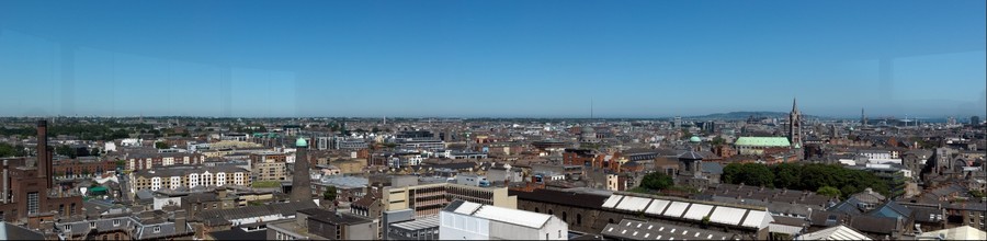
St. Patrick's Cathedral -- Dublin

St. Patrick's Cathedral and Park
 St. Patrick’s Cathedral is the largest church in Ireland and believed to be the earliest Christian site in Ireland where St. Patrick baptized converts.  Interestingly, Dublin has two cathedrals that belong to the Church of Ireland and they act as co-cathedrals for the city.  The Archbishop of Dublin has his official seat in the other one, Christ Church Cathedral Dublin.

Christ Church is the official Cathedral of the Dublin Diocese, while St. Patrick’s is considered the National Cathedral.

St. Patrick’s has had a church on this site since the fifth century.  A wooden building stood here until 1191 when the church was granted collegiate status.  It reached official cathedral status in 1224.  The present building was built between 1191 and 1270.

During the 1860s, the building was believed to be in danger of collapsing and a major rebuilding project by Sir Benjamin Lee Guinness resulted in the Gothic Revival building we see today.  Unfortunately, failure to preserve records during this time means that it is difficult to discern which parts of the building are actually medieval and which is part of the Victorian remodeling.

Nave of St. Patrick's Cathedral

Currently, it is also the location for the celebration of Remembrance Day in November hosted by the Royal British Legion and attended by the President of Ireland.

The building has served as both a Roman Catholic and an Anglican church (its current status).  Worship services are still held daily.

Download the free app St. Patrick’s Cathedral Dublin before touring the site.  Visit here for a beautiful 360-degree tour of the nave.

Interesting Historical Notes

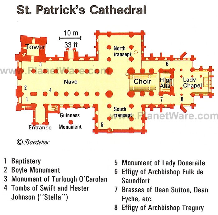
Jonathan Swift, author of Gulliver’s Travels, served as Dean (head) of the cathedral from 1713 to 1745. His grave can be seen on floor of the cathedral located almost immediately to your right as you enter the cathedral from the southwest porch.  

Jonathan Swift's grave
Here you find not only Swift’s grave but that of his long-time companion, Esther Johnson, aka Stella.  On the wall nearby, you will find Swift’s Latin epitaph to the two of them and a bust of Swift.

The first ever performance of Handel’s Messiah was performed here in 1742.  The composition is on display in a glass case in the cathedral.

As a show of disrespect, Oliver Cromwell stabled his army’s horses in the nave of the cathedral during his stay in Dublin in 1649.

Before the disestablishment of the Church of Ireland in 1871, the installation ceremony for the Knights of St. Patrick had been held in the cathedral since 1783.  Although the ceremony was moved to St. Patrick’s Hall in Dublin Castle, the heraldic banners of the knights at the time of the move still hang above the choir stalls.

St. Patrick's Cathedral and Park
St. Patrick’s Park, the expanse of green beside the cathedral, was a crowded slum until it was cleared and its residents ejected in the early 20th century.  A stone in the park marks the spot of the “holy well” where tradition says St. Patrick baptized his converts.  A Celtic cross on display in the cathedral and uncovered in the garden next door is believed to have covered this well.


The elaborate Boyle Monument was erected in 1632 by Richard Boyle, Earl of Cork, as a tribute to his family.  The kneeling five-year-old boy is his son Robert Boyle, who grew up to become the famous scientist for whom Boyle’s Law is named relating to the pressure and volume of gases.

The St. Patrick’s Choir School was established in 1432 and is an all-male choir that still recruits young men.  The choir itself actually dates to 1220.

The Organ of St. Patrick’s Cathedral has over 4,000 pipes and parts of it date to 1695. 

Visit here for an in-depth view of the cathedral’s history via a timeline, a video gallery, and cathedral tales.

Thursday, May 21, 2015

Guinness Storehouse -- Dublin, Ireland

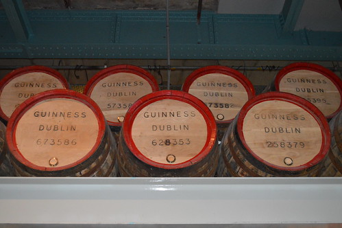
Barrels of Guinness Beer
One simply cannot think of Dublin without envisioning a traditional Irish pub…and a dark pint of Guinness that inevitable is associated with it.  All that bubbly brew is produced right in the heart of Dublin at the St. James’s Gate Brewery…one of the largest (and most famous) breweries in the world.

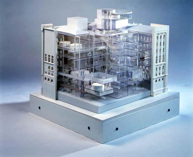
The Guinness Storehouse is the seven-story building located at the center of the brewery that has been remodeled inside to resemble a giant pint of Guinness where all floors are designed around a central glass atrium mirroring the shape of the famous pint.  If full the ‘atrium’ pint would hold 14.3 million glasses of the black brew.

The storehouse was once the fermentation plant, but today entertains visitors by acquainting them with every aspect of the famous stout’s production; from making the beer barrels in the cooperage to the creation of the world famous brand.  It is a rich history indeed.

One will even learn how to properly pour a beer.  (A ‘perfect’ pour of Guinness should take 199.5 seconds at a 45-degree angle.)  Watch this video to see how a master brewer pours a pint—How to Pour a Perfect Pint of Guinness (2:22)

Guinness's signature dark brew
Guinness stout is made from four natural ingredients—water, barley, hops and yeast.  The interactive self-guided experience allows visitors to view the brewing process first-hand, smell the hops, touch the barley, hear the waterfalls, and learn every aspect of the brewing process from recipe to marketing.  Inside the Guinness Storehouse – Ingredients and Waterfall (0:30)

The highlight of the tour for many is the opportunity at the end of the tour to partake in a freshly-brewed pint of world-renowned Guinness beer at the Gravity Bar and the 360-degree panoramic views across Dublin from the top floor.  Inside the Guinness Storehouse – The Gravity Bar (0:35)

Founded in 1759 by Arthur Guinness, the operation has expanded over the years down to the River Liffey and across both sides of the street and at one point had its own railway.  A giant gate once stretched across James Street…hence the name of the brewery.

Guinness was originally called Porter and then Stout Porter, before its name changed in the 18th century.  In the 1930s, Guinness employed over 5,000 workers.  With industrialization of the process, the company employs about 600 people, but still produces 2.5 million pints of stout every day.

Join National Geographic as they explore Guinness Beer (45:33) in this documentary.

What to Expect

Guinness Storehouse Gravity Bar
Upon entering the pint glass-shaped building, visitors find themselves in the Atrium on the ground floor.  Here they find the extensive retail store and the beginning of the interactive exhibit, including the company’s 9,000 year lease.

After getting familiar with the main ingredients in Guinness, people are directed to the next level to learn about the brewing process and the different variations of Guinness that are on the market.  Floors 2 through 6 take visitors on an interesting journey back in time to discover the history behind Arthur Guinness, the company and the Guinness Storehouse itself.

By the time visitors reach the 7th and final floor, they will be caught back up to the present and ready to enjoy their pint of the legendary brew in the Gravity Bar.

Saturday, May 16, 2015

Dublin Castle -- Dublin, Ireland

Round Tower at Dublin Castle
Dublin Castle, currently a working Irish government building, has served as a prison, the treasury, a military fortress, and court of law over the last 700 years.  In addition it served as the seat of administration of the English government in Ireland until the formation of the Republic of Ireland in 1921. 

Today the sprawling complex of historic buildings is used for important state receptions and Presidential Inaugurations every seven years.  Every ten years, the castle serves as the central base as Ireland hosts the European Presidency.  On occasions, Dublin Castle may close on very short notice for state business.

Located in the heart of historic Dublin, it was built in the 13th century on a site originally settled by Vikings and has been remodeled numerous times over the centuries.  It includes the State Apartments (built as the residential quarters of the Viceregal court), Undercroft (where portions of the Viking fortress and the 13th century castle are on view), Chapel Royal, the Chester Beatty Library, the Revenue Museum, Craft Shop, Heritage Centre, and restaurant.

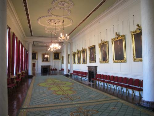
Dublin Castle Drawing Room
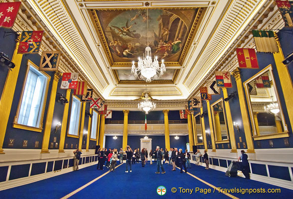
The castle features amazing architecture, as well as intriguing exhibits, artifacts, and state treasures.  Places of note inside the State Apartments are the State Corridor, the State Drawing Room, the Throne Room, the Picture Gallery or State Dining Room, the Bedford Tower, and the beautiful St. Patrick’s Hall, the grandest room in the State Apartments used for presidential inaugurations.

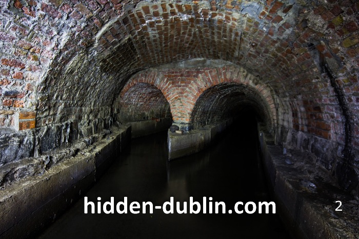
The castle stands on the rim of a strategic site at the junction of the River Liffey and its now underground tributary, the River Poddle, where an original fortification may have been an early Gaelic ring fort.  The Great Courtyard today corresponds with these early fortifications and with the Record Tower as the last intact medieval tower in Dublin.

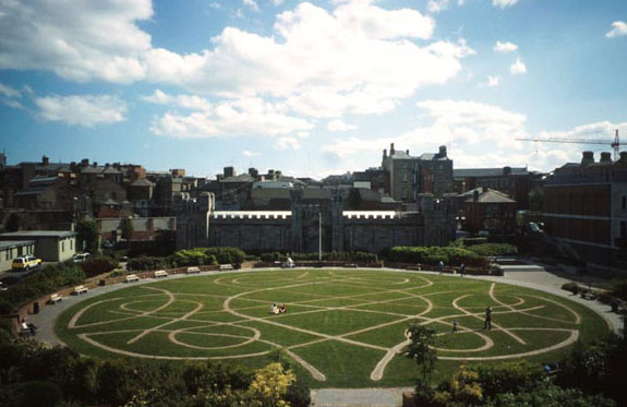
The city gets its name from Gaelic ‘Dubh Linn,’meaning Black Pool or Black Water, which was on the site of the present Castle garden.  Of note, the Irish crown jewels were stolen from the castle in 1907 and have never been recovered.

Dublin Castle Throne Room
Dublin Castle has appeared in numerous films including Barry Lyndon, Michael Collins, Becoming Jane and The Medallion, as well as the television series The Tudors, where it doubled as the Vatican in the pilot.

Roll your mouse over this interactive map of Dublin Castle to learn more about its various buildings.  Click on the links to the left on this site to learn more about specific areas.  Read Dublin Castle’s complete history.

Watch these videos to get an overview of the Dublin Castle complex:

Irish National Anthem at Presidential Inauguration—Dublin Castle (1:14)  'Amhrán na bhFiann' played out in St. Patrick's Hall at Dublin Castle as Michael D. Higgins is inaugurated as the ninth President of Ireland in 2011.


Saturday, May 9, 2015

Book of Kells--Dublin, Ireland

The Book of Kells -- Christ Enthroned
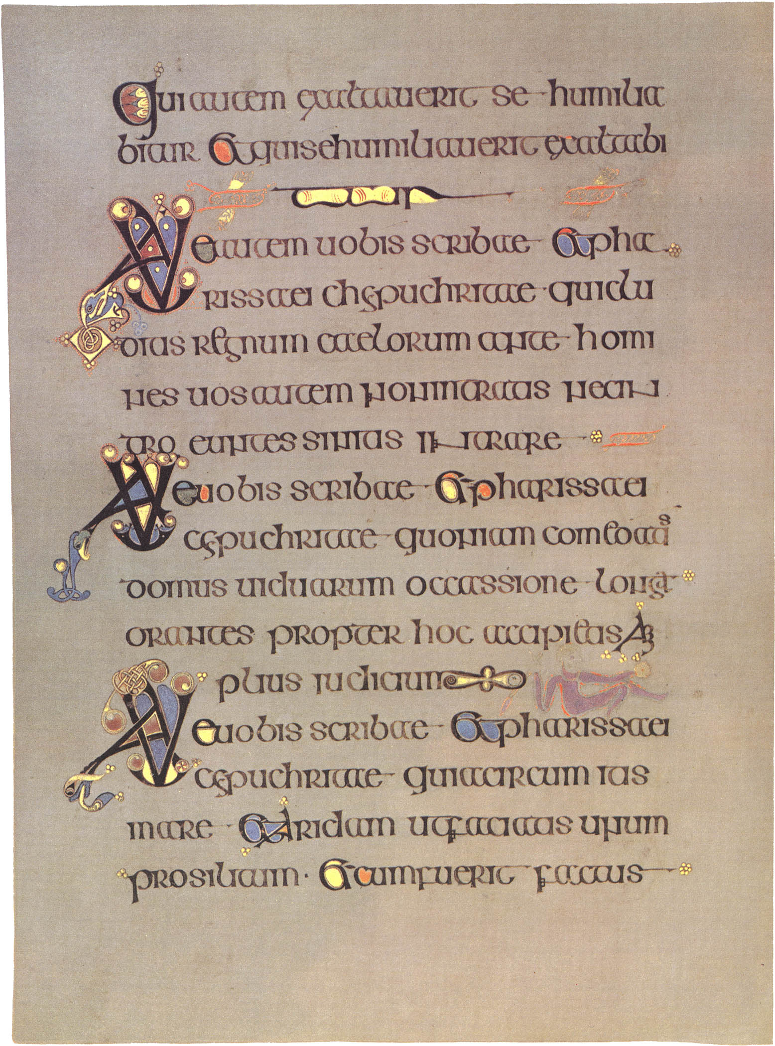
The Book of Kells is Ireland’s most treasured medieval artifact.  It is recognized as possibly the finest illustrated manuscript from medieval Europe.

It is generally accepted that the document was produced in the scriptorium of a monastery on the Isle of Iona, Scotland, to honor Saint Columba in the early 8th century.  It was later moved to Kells, Ireland, by the Columban monks after a Viking raid in 806 AD.  It is possible the monks may have worked on the manuscript at both locations.

The document was then stolen in the 11th century and the cover, which likely was covered in gold and precious jewels, was torn off and the manuscript thrown into a ditch.  Although the book suffered some water damage it is still in remarkable condition.  The cover has never been found.

In 1541, at the height of the English Reformation, the book was taken by the Roman Catholic Church for safekeeping, but was returned to Ireland in the 17th century.  It was in the collection of Archbishop James Ussher when he died and given to Trinity College by his nephew Henry Jones where it remains today in the Old Library on campus.

Since 1953, the manuscript has been bound in four volumes.  On any given day, Trinity College Library will display two of the volumes, one opened to a fully illuminated folio while the other is opened to typical text pages.
The Book of Kells on display at Trinity College, Dublin

The Book of Kells is an illuminated manuscript which contains the four Gospels in Latin according to the Vulgate text which St. Jerome completed in 384 AD, intermixed with readings from the earlier Old Latin translation. 

The Gospel texts are prefaced by other texts, including “canon tables,” or concordances of Gospel passages common to two or more of the evangelists; summaries of the gospel narratives (Breves causae); and prefaces characterizing the evangelists or authors (Argumenta)—Matthew, Mark, Luke, and John.

The book is written on vellum (prepared calfskin) in a bold and expert version of the script known as “insular majuscule.”  It contains 340 folios (680 individual pages), now measuring approximately 330 x 250 mm.  Over the years the pages have been severely trimmed, and their edges gilded, in the course of rebinding in the 19th century.

Ten different colors were used in the illumination using Celtic motifs and Christian symbolism, some of which cover entire pages while other pages have illuminated characters.  Only two of the pages have no illumination at all. 

Some of the colors are rare and had to be imported from the continent, and some of the workmanship is so fine that it can only clearly be seen with a magnifying glass. 

To learn more about the Book of Kells, watch this 7-part documentary.
Part 1 (9:56)
Part 2 (9:57)
Part 3 (9:56)
Part 4 (9:57)
Part 5 (9:57)
Part 6 (9:51)
Part 7 (8:25)

Trinity College Library Dublin has made the Book of Kells free to view online in its entirety through its Digital Collection.   

In 2009, an animated feature, The Secret of Kells, was released depicting a mystical tale of the making of the book.  It was nominated for an Academy Award for Best Animated Feature.
Old Library at Trinity College

Friday, April 24, 2015

Glendalough -- Ireland

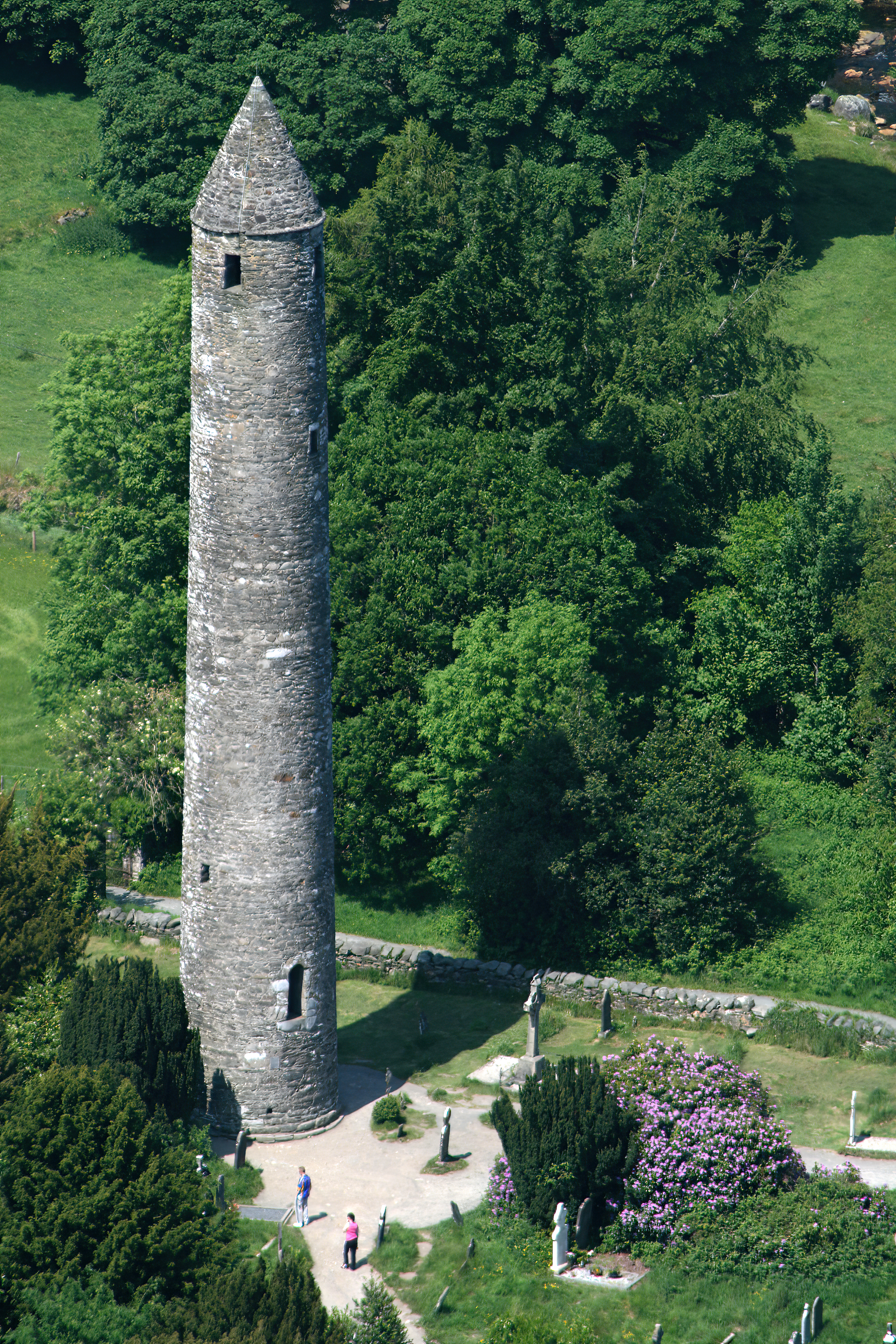
Glendalough Round Tower
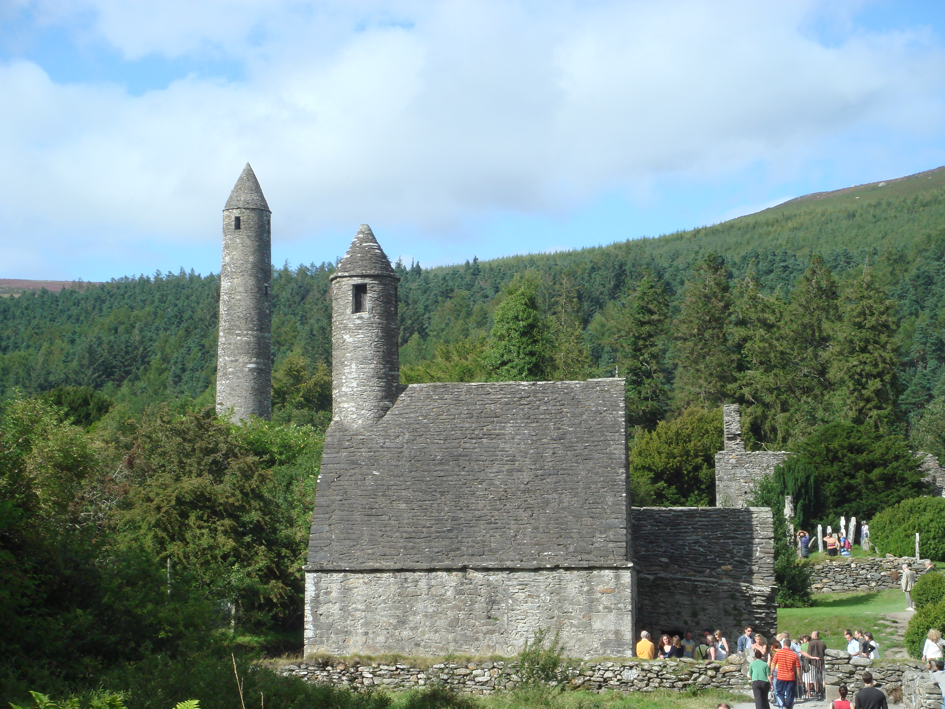
Glendalough represents iconic Irish countryside.  Nestled in a glaciated valley in the heart of County Wicklow, this serene valley boasts two lakes, monastic remains with a superb round tower, stone churches, and decorated crosses in an historical graveyard. Literally the name, Gleann Dá Loch, means “Valley of the Two Lakes.”

History
The early Christian ecclesiastical settlement was founded in the 6th century by St. Kevin, a hermit monk who died about 618 A.D.  A descendant of one of the ruling families of Leinster, he came to live at Glendalough (pronounced ‘glenda-lock’) as a young man.  According to legend, he lived a life of sleeping on stones, wearing animal skins, barely eating, and making friends with birds and animals.

By the 9th century, Glendalough rivaled only Clonmacnoise as one of the leading monastic cities in Ireland.  In its heyday, the settlement not only featured a monastery and monk cells, but also an infirmary, workshops, areas for manuscript writing and copying, guesthouses, farm buildings and houses.  Most of what survives today is from the 10th-12th centuries.

In 1214, the dioceses of Glendalough and Dublin were combined and the settlement fell into ruin destroyed by English forces in 1398.  The Feast of St. Kevin is celebrated on June 3.

Glendalough is currently a titular see in the Catholic Church.  It is used for bishops who hold no ordinary power of their own and thus are titular bishops.

Visiting Glendalough
Upper Lake at Glendalough
The two lakes at Glendalough are known as Upper Lake and Lower Lake, where the main entrance from the parking area, a visitor centre, the main monastic dwellings, and a hotel are located.  Walking trails connect the two lakes and other monastic sites.

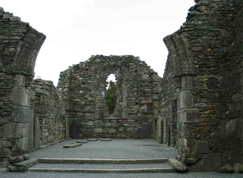
Visible at Lower Lake are the double-arched medieval gateway; the Cathedral, the largest building; St. Kevin’s Cross with an unpierced ring; the reconstructed priests’ house; St. Kevin’s Church (or Kitchen) with its distinctive round belfry; foundations of St. Kieran’s Church; and the iconic round tower.

The round tower possibly served as a belltower, a place of refuge when under attack, and/or a storage facility.  It originally had six timber-floored stories with the doorway to the tower 3-1/2 meters above ground to protect those inside from intruders.

Small windows at the top face the four points of the compass, and stories were accessed by internal wooden ladders.  The conical roof was replaced in 1876 from original stones.

Additional monastic structures – St. Mary’s Church, the Caher,  Reefert Church, and St. Savior’s Church – can be visited on the hike to Upper Lake. Temple-na-Skellig and St. Kevin’s Bed, a cave, are only accessible via boat.

Crosses of Glendalough
There are nine marked walkingtrails in Wicklow Mountains National Park ranging from a short half hour walk to a four-hour hillwalk.  The park is host to a wide diversity of wildlife including red deer, sika deer, fallow deer, feral goat, red fox, mink, and over 100 species of birds.  The common lizard is the only reptile in the park, as there are no snakes in Ireland.

The visitor center located nearby hosts an interesting exhibit and a 17-minute film entitled “Ireland of the Monasteries.”


Join Rick Steves in this video: “Glendalough, Ireland: Exploring the Wicklow Mountains.”  (Watch only the first 1:55 minutes.)
For a unique birds eye view, enjoy this video: “Glendalough.” (3:40)


Friday, April 17, 2015

Irish National Stud and Gardens -- Ireland

Thoroughbreds at the Irish National Stud
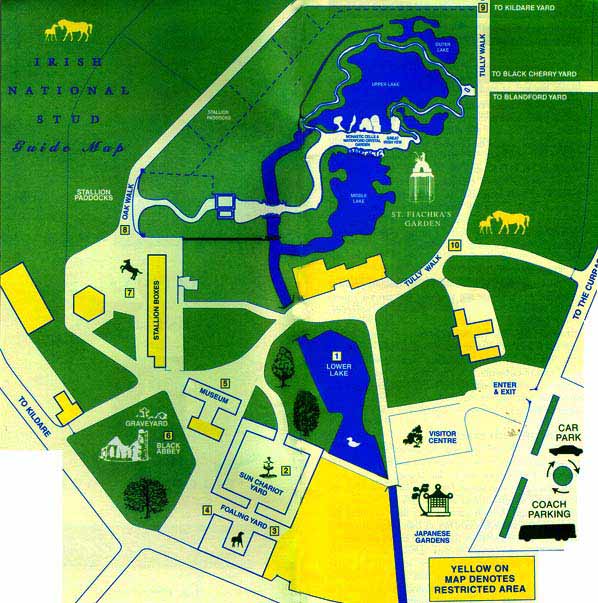
The Irish National Stud and Gardens located in County Kildare, Ireland, is where horse racing legends are born and the only one in Ireland open to the public.  Also located on the grounds are the world famous Japanese Gardens, the Horse Museum, and St. Fiachra's Garden, created to celebrate the Millennium.

The thoroughbred horse racing facility, which now belongs to the people of Ireland, is located on the 1,000-acre Tully Estate, home to some of the finest thoroughbreds in the world including these living legends who live(d) out their days in retirement at the stud:  “Beef or Salmon,” “Kicking King,” “Hardy Eustace,” “Rite of Passage,” “Moscow Flyer,” and “Vintage Crop.”

Tully’s famous stud farm where racehorses are conceived, born, and raised was bought from the Fay family by Colonel William Hall-Walker in 1900.  He became one of the most successful breeders of his time.  His finest hour came when King Edward VII led “Minoru,” born and raised at Tully, into the winner’s circle at the 1909 Derby.

The Horse Museum features a life size skeleton of “Arkle,” the famous steeplechaser who raced in the sixties.  He was a three-time winner of jumping’s ultimate prize, the Cheltenham Gold Cup.  Watch “Arkle” win the 1964 Gold Cup here (2:20).  “Sea the Stars” is the stud’s most modern champion and the museum houses much of his memorabilia.

Japanese Gardens
The Japanese Gardens were devised by Col. Hall-Walker (later Lord Wavertree), a wealthy Scotsman from a famous brewery family, and laid out between 1906 and1910 on four acres of woodland and lakeside walks by Japanese master horticulturist Tassa Eida and son Minoru (for whom the famous horse is named).

The natural habitat, carefully preserved as part of Ireland’s heritage, was planned to symbolize “The Life of Man,” tracing a soul from birth to death and beyond.  In addition to the flora, there are ponds, waterfalls, rock structures, bridges, and a tea house.  (For a complete description of the symbolism of the gardens, go here and scroll to read “The Japanese Gardens.”)

St Fiachra's Garden
In 1999, Saint Fiachra’s Garden was created to honor the patron saint of gardeners.  Designed by Professor Martin Hallinan, an award winning landscape architect, this natural environment was created to simulate the spirituality of the monastic movement in Ireland in the 6th and 7th centuries.  It features unique water spots and replicas of monastic ruins.

Consult this guide map to plan your visit and consider the following suggested time schedule for touring:
National Stud: 1 hour
Japanese Gardens: 20 minutes
St. Fiachra’s Garden: 45 minutes
Horse Museum: 20 minutes

Enjoy these related videos.
For a mini tour of the horse pastures: Irish National Stud (2:55)
For a peaceful tour of the Japanese Gardens: Japanese Gardens County Kildare (8:41)


Tuesday, April 14, 2015

Corcomroe Abbey -- Ireland


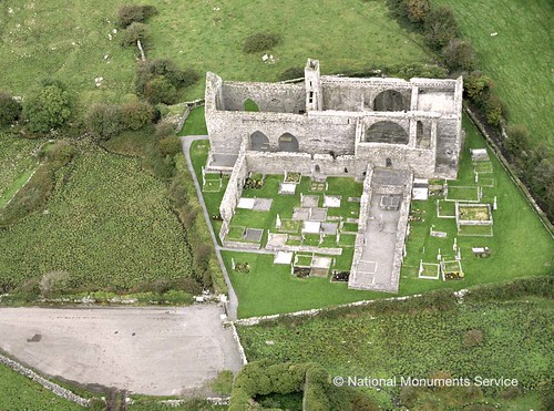
Corcomroe Abbey in The Burren
Located in a fertile green valley of the Burren, County Clare, Ireland, the ruins of Corcomroe Abbey are remarkably well-preserved.  Uniquely picturesque in its isolation on the Burren, the abbey is situated close to three small deserted Christian churches dedicated to St. Colman and nestled in the pass of Oughtmana.

Early monks sought out isolated areas to settle and became self sustained.  The abbey became known as “Sancta Maria de Petra Fertili”—St. Mary of the Fertile Rock, as the Burren provided all the monks needed to maintain a Cistercian community through cultivating the surrounding fertile lands.

Corcomroe Abbey is said to have been established by Donal MĂłr Ua Briain in the late 12th century and continued to function for the next 400 years.  The last abbot named was John O'Dea, a Cistercian from the Irish College at Salamanca, in 1628.

The abbey is noted for its beautiful architectural detail still visible in its ruinous state and not found in other structures of this period.   It features a typical cruciform church facing east, with a small chapel in each transept. 

Magnificent arches still reign over chapel entries, although one entrance has been sealed off for burials—both ancient and modern.  Parts of the remaining roof still bear some finely carved rib vaulting in the Romanesque style.

Capital details - human masks and floral detail
The capitals are decorated with lotus leaves and other botanic detail, while some carved human masks and dragon heads are visible in the transept chapels.

The choir is constructed with high quality stonework and in the north wall can be seen a tomb-niche holding a recumbent effigy of King Conor na Siudaine Ua Briain who died in 1267, one of the very few examples remaining of an Irish Chieftain.  He was a benefactor of the abbey and grandson of the founder. 

Effigy of King Conor na Siudaine Ua Brianin
The English Reformation led to the dissolution of Catholic monasteries in England and Ireland. In 1554, the abbey was granted to the Earl of Thomond. 

The site is under state care and a National Monument of Ireland.  The graveyard surrounding the abbey is still in use, so care must be taken not to disturb the site.

Look for the ring fort dissected by the road on the way out, identifiable by the raised circular mound topped by hawthorn trees.

Saturday, February 28, 2015

The Burren in Western Ireland

Rolling hills of The Burren
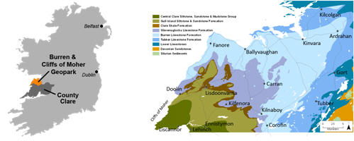
 Not far from the Cliffs of Moher in the west of Ireland lies The Burren, or "BoĂ­reann" meaning a rocky place.  And it is that indeed...close to 125 square miles of limestone rock covering imposing majestic mountains and tranquil valleys with gently meandering streams.  Geologists marvel at underground rivers, caves, depressions, plateaus, and other fascinating geological formations.

Formed millions of years ago under a tropical sea and later carved by glaciers, the flowing ice rounded the hills and left deposits of huge boulders and criss-crossing cracks known as "grikes."  This erosion process left a barren landscape, however it has been referred to in the past as "fertile rock" due to the mixture of nutrient rich herb and floral species.   

In 1651, a Cromwellian Army Officer named Edmund Ludlow remarked, "of this barony it is said that it is a country where there is not water enough to drown a man, wood enough to hang one, nor earth enough to bury them. This last is so scarce that the inhabitants steal it from one another and yet their cattle are very fat. The grass grows in tufts of earth of two or three foot square which lies between the limestone rocks and is very sweet and nourishing."

The Burren region is internationally famous for its landscape and diverse flora.  Summer visits treat the visitor to a colorful array of plants and flowers.  Over 600 different flowering plants have been recorded in the Burren.  Arctic, alpine, and Mediterranean plants thrive side-by-side.

Megalithic tomb - Poulnabrone
The area is also known for more than 90 megalithic tombs, monuments, and ring forts, older than the Egyptian pyramids.  One of the more famous megalithic tombs, the portal dolmen at Poulnabrone, dates back to around 2,500 BC.  'Dolmen' is Breton for 'table', which is what a dolmen looks like - a large capstone on two or three standing stones.

The ring forts also testify to human presence on the Burren, among them the triple ring fort Cahercommaun on the edge of an inland cliff, and the exceptionally well-preserved Caherconnell Stone Fort.

A stop at the Burren Vistor Centre in the picturesque village of Kilfenora, Ireland’s first interpretive centre, presents a 12-minute film that introduces the visitor to this unique and fascinating region.  The exhibition area enables the visitor to experience the development of the Burren and its civilization from formation 320 million years ago to how the Burren is today.

The centre also hosts a celebration of traditional Irish music dedicated to the history and music of  The Kilfenora CĂ©ilĂ­ Band.

Enjoy this overview video of The Burren (6:39).


Friday, February 20, 2015

The Cliffs of Moher--Ireland

Cliffs of Moher and O'Brien's Tower
One of the most well-known natural wonders in Ireland are the amazing Cliffs of Moher on the island’s western coast which tower over 700 feet above the Atlantic and stretch for over five miles.  Situated in County Clare on the southwestern edge of the Burren region, the towering cliffs were carved by time, ocean, and weather…and the erosion process continues.

On a clear day, one can see from the Aran Islands and Galway in the north to the Dingle Peninsula and Blasket Islands in the south.  O’Brien’s Tower stands near the highest point of the cliffs and has served as a viewpoint for visitors for hundreds of years.  The round stone tower stands midpoint of the cliffs with trails along the edge.

The cliffs were formed millions of years ago when heavy rainfall on land created great floods that washed sand and mud into ancient rivers and then out to sea.  The cliffs are forever changing as the sea constantly erodes the cliffs from the bottom creating caves and sea stacks.

One of the most well-known sea stacks, Branaunmore at the foot of the Cliffs of Moher and below O’Brien’s Tower, stands 220 feet high.  Further west along the coast a number of sea caves have eroded.  One was featured in the 2009 movie Harry Potter and the Half Blood Prince.

Several other movies have been filmed in and around the Cliffs of Moher including The Princess Bride (1987), Ryan’s Daughter (1970), and The Guns of Navarone (1961).

Cliff's of Moher
Human presence on the cliffs dates back to the first century BC when a fort called Moher stood where the modern Moher Tower now stands at its southernmost point near Hag’s Head.  Steeped in legend two thousand years ago, the cliffs have served mankind as a place of lookout, fishing, quarrying, collecting eggs and feathers…and in the last few hundred years as a tourist destination.

Lucky visitors to the cliffs are occasionally treated to traditional Irish music when various individuals and groups perform…anything from the Celtic harp to lively Irish jigs and reels.

The Cliffs of Moher Visitor Experience built into a hillside provides an in-depth look at the area, and O’Brien’s Tower lies just to the south of this visitor centre.  The tower was built in 1835 by Cornelius O’Brien, a descendant of Brian Boru, the High King of Ireland.

O’Brien was a local landowner and a man ahead of his time.  He believed that the development of tourism could benefit the economy and bring the Irish people out of poverty.

Most likely our visit will not take us on a walking tour along the entire Cliffs of Moher (5:12) as seen in this video, but watching it shows some of the fantastic views along its stretch.  Planning Your Visit to the Cliffs of Moher (7:10) video is excellent to give you an overview of access to the visitor centre and the cliffs near it.


Wednesday, October 15, 2014

Ireland vs. Northern Ireland...What's the Difference?

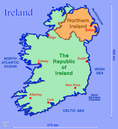
Technically speaking, Ireland is the island.  But on this island are two separate political countries…the Republic of Ireland and Northern Ireland.  The Republic of Ireland is an independent sovereign nation.  Northern Ireland is part of the United Kingdom of Great Britain, which also includes Scotland, Wales, and England.

Until 1921, Ireland was one undivided country under British rule.  So why are they split? What started as a religious issue between the Protestants and the Catholics, has now become a social and cultural conflict.

Traditionally, Ireland is a Catholic country.  There are still Catholics in Northern Ireland, but when citizens of England and Scotland started emigrating to the northern part of Ireland 500 years ago, they brought their Protestant religion with them, so they feel more culturally linked to Great Britain through their Protestant ancestors.

(Remember England was also Catholic until King Henry VIII got mad at the pope in the 16th century for not recognizing his marriage annulment from Queen Catherine so he could marry Anne Boleyn.  In defiance he “protested” and started the Church of England.)

Under pressure from the mostly Protestant population in the North to remain with the Protestant United Kingdom, the British and Irish governments forced the division of the island into the north and the south.

The IRA (Irish Republican Army) is a Catholic paramilitary organization whose goal is to force the British out of Northern Ireland.  This terrorist group organized in 1919 and is believed responsible for hundreds of deaths in the late 20th century.

The period after 1968 is referred to as “The Troubles.”  British soldiers came in 1969 to restore order but unfortunately took sides and discrimination of Catholics continued.  Extremists from both sides took the law into their own hands resulting in thousands either killed or imprisoned.

Ireland governs itself, and so did Northern Ireland until the 1960s when the civil unrest forced Great Britain to impose Home Rule.  In the early 21st century, Northern Ireland regained some of its independent government, but it continues to remain under British Sovereign law. 

There are also a few other differences.  For example, the Republic of Ireland uses the euro for its currency, while Northern Ireland uses the pound sterling as part of the United Kingdom.  In addition, speed limits in Northern Ireland are shown on signs as miles per hour, while Ireland uses kilometers.  And look at the mailboxes: Northern Ireland mailboxes are red, while those in the Republic of Ireland are green.  That helps you tell when you’ve crossed the border.

Regardless of their differences, the two countries both approved the Belfast Agreement, also known as the Good Friday Agreement, in 1998 which stated that the majority of the people of Northern Ireland want to remain a part of the United Kingdom and that a substantial number of people in Northern Ireland and most of the people of the island of Ireland want a united Ireland.

The agreement basically says that both viewpoints are equally legitimate and that the two countries will remain as they are until the majority of both Northern Ireland and the Republic of Ireland want the two united.  The political leaders Catholic John Hume and Protestant David Trimble later received the Nobel Peace Prize for their contributions.

However, in many places in Belfast, the lines are still drawn.  “Peace Lines” (walls topped by barbed wire) can still be seen segregating factions of Catholic supporters and Protestant supporters. 

Northern Ireland mural 
Although Northern Ireland is a more peaceful place, one can still see, especially in Belfast, territorial flags, murals, or curbstones painted red, white, and blue for Protestant Loyalists or orange, green, and white for Catholic Republicans.

Tourists are encouraged not to show any support to either faction while traveling through these areas by wearing group colors or waving union flags.  Just to be safe, avoid initiating conversation with locals on politics or religion, and shy away from political demonstrations or controversial parades.  It is best to err on the side of caution.

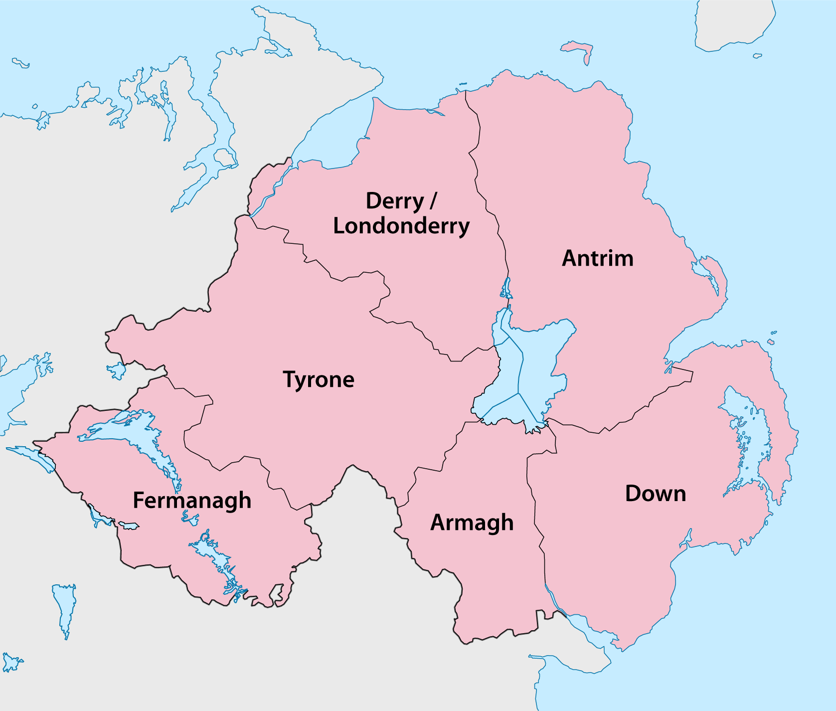
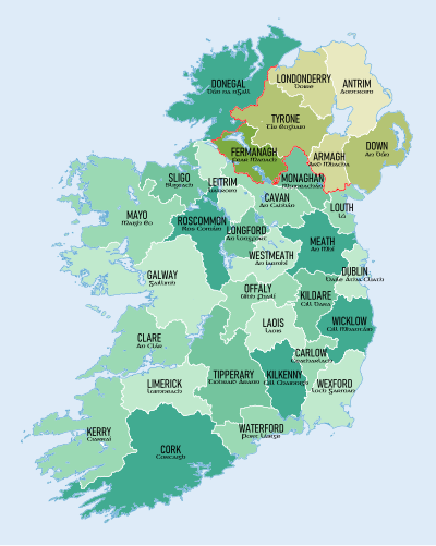
Today Northern Ireland is composed of six counties, while Ireland has 26 counties.  Confusingly, Northern Ireland is also a part of the province of Ulster (one of four ancient Irish provinces), which also includes three counties from the Republic of Ireland.

Still confused?  Watch this video “Get It Right” (1:16) and see just how “simple” it is!

The first half of this video from Rick Steves “Belfast and the Best of Northern Ireland” (26:08) explains a little more about Belfast and the Troubles. 

And if you are a history buff, you might like this entertaining video “A Brief History of the Conflicts in the North (of Ireland) (10:24).” It begins at THE beginning and carries you through to current times.  (Note: Remember to breathe somewhere in the middle of it.  It carries you pretty fast!)

Saturday, September 21, 2013

2015 Slide Show of Tour Highlights

Experience Ireland and the Scottish Highlands

We are planning our next tour and it will be to beautiful Ireland and the Scottish Highlands.  The 10-day tour is June 22-July 1, 2015.

This is a one-of-kind customized tour combining some unique sites not found in many tours to Ireland and Scotland.  Highlights of the tour include: a train ride through the Scottish Highlands, the Giant’s Causeway in Northern Ireland, and the Cliffs of Moher on the Atlantic shores of Ireland.

If your heritage traces back to Ireland, then you’ll be able to step back in time at the Ulster American Folk Park and see just how your ancestors lived before immigrating to the New World.  And if nature is what you prefer, there will be no end to the diversity you’ll enjoy!

To get a closer look at what you will experience on the tour, then watch the slide show below that highlights these locations and many more.  Simply click on this link, or click in the box below.  (Note: I’ve found it works best when viewing with the Google Chrome browser. Also it uses Flash Player so may not play on iPads or iPhones, so use link above.)


Click on the forward button in the middle of the screen to start the show.  To advance the slides, click on the forward button at the bottom left to view this size.  To view full screen, click on the square in the lower right corner of the slide show and simply click your mouse on the screen to advance the slide show.  Enjoy!