Showing posts with label mountains. Show all posts

Friday, August 12, 2016

Sugarloaf Mountain in Rio

Sugarloaf Mountain on Guanabara Bay
If you are watching the Summer Olympics in Rio, in almost every aerial shot of the city is the Christ the Redeemer Statue, and just across Guanabara Bay you’ll see the iconic cone shaped hill that also defines Rio de JaneiroSugarloaf Mountain, or Pão de Açúcar in Portuguese.

Rising 1,299 feet, it sits at the mouth of the bay on a peninsula that juts out into the Atlantic Ocean overlooking the harbor.  It gets its name from the traditional shape of concentrated loaf sugar, a name coined by the Portuguese in the 16th century during the heyday of the sugar cane trade in Brazil.

Cable car ride up to Sugarloaf Mountain
It is known for its cable car ride to the summit and the majestic 360-degree views of Rio from the top.  The first aerial tram opened in 1912 and those wooden cars were used for 60 years.  In 1972 the tram system was upgraded to carry ten times the passengers, up to 65 people.

To reach the summit, passengers actually take two cable cars.  Sugarloaf is only one of many hills to rise along the water’s edge in Rio.  The first car rises from Praia Vermelha (Red Beach) to the shorter Morro da Urca for 722 feet, and the second ascends to Sugarloaf Mountain. 

The 360-degree views you'll enjoy along the ride and from the top of Morro da Urca and Sugarloaf Mountain encompass Rio beaches – Flamengo, Botafogo, Leme, Copacabana, Ipanema, Leblon – the Corcovado, Guanabara Bay, downtown Rio, the Santos Dumont Airport, the Rio-Niterói Bridge and Dedo de Deus (God's Finger), a peak which rises from Brazil's coastal range (Serra do Mar) in Teresópolis, RJ, about 50 miles from Rio.

Sunset at Sugarloaf Mountain
The entire ride in the bubble shaped cars takes about six minutes.  The cable cars run from 8 a.m. until 9 p.m. in 20-minute intervals.  Currently tickets are about $20.  One of the best times to visit is sunset for the spectacular views.

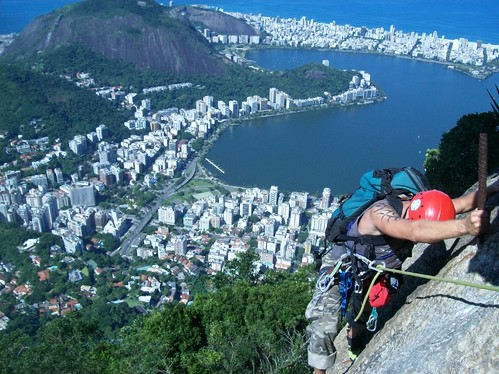
Visitors can watch rock climbers on Sugarloaf and neighboring Morro da Urca (Urca’s Mountain) and Morro da Babilônia (Babylon Mountain).  Together they make up one the world’s largest urban rock climbing locations. (And incidentally, you just learned your first word in Portuguese…morro = mountain!)

Sugarloaf Mountain has made its mark in cinema.  It was featured in the 1942 Bette Davis movie Now, Voyager.  In 1979, James Bond shot a fight scene for Moonraker in one of the cable cars.  And even The Simpsons cartoon featured the iconic mountain in an episode.

Watch this video and enjoy a virtual ride on the Sugarloaf Mountain cable car.

Friday, April 24, 2015

Glendalough -- Ireland

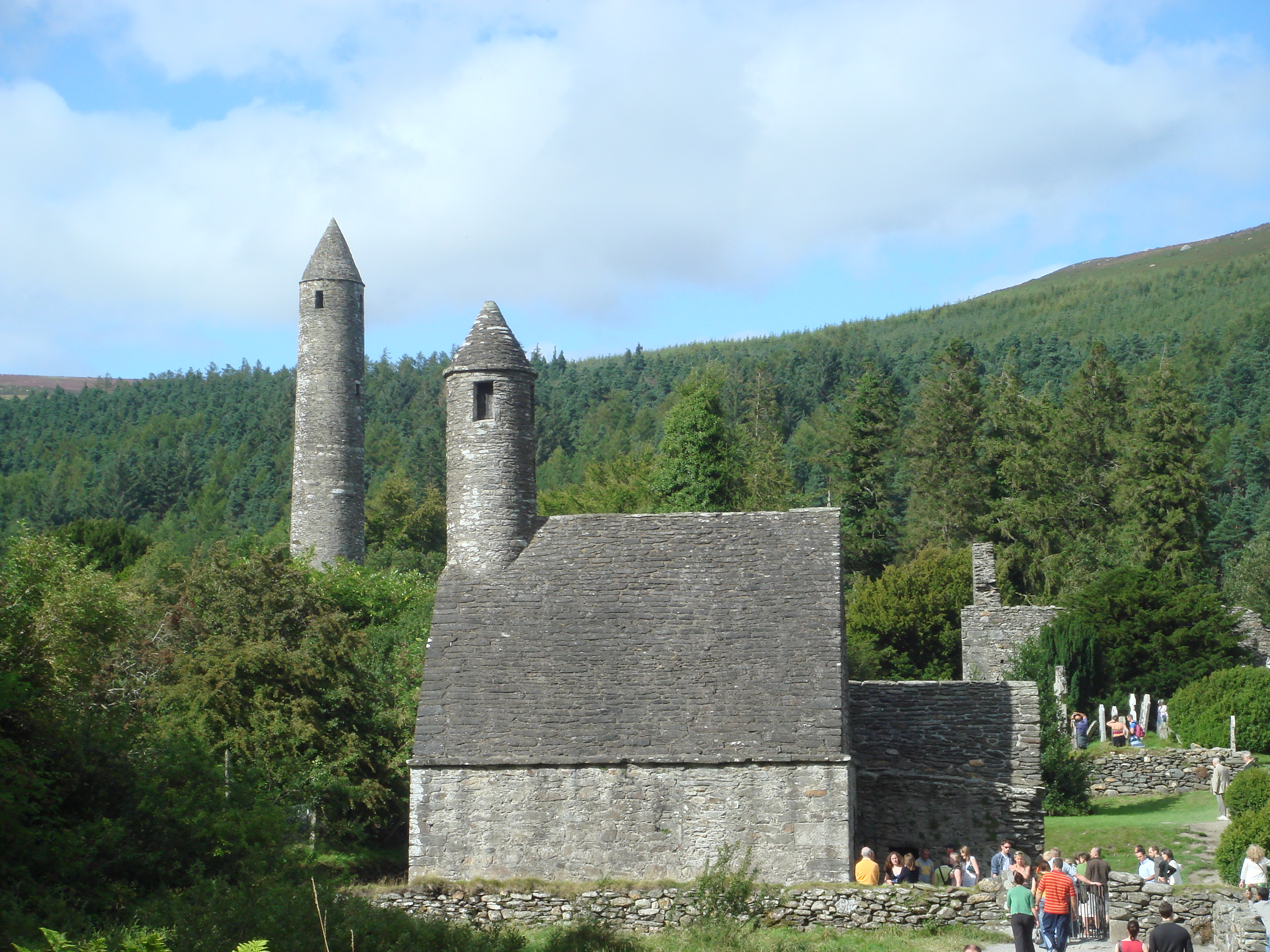
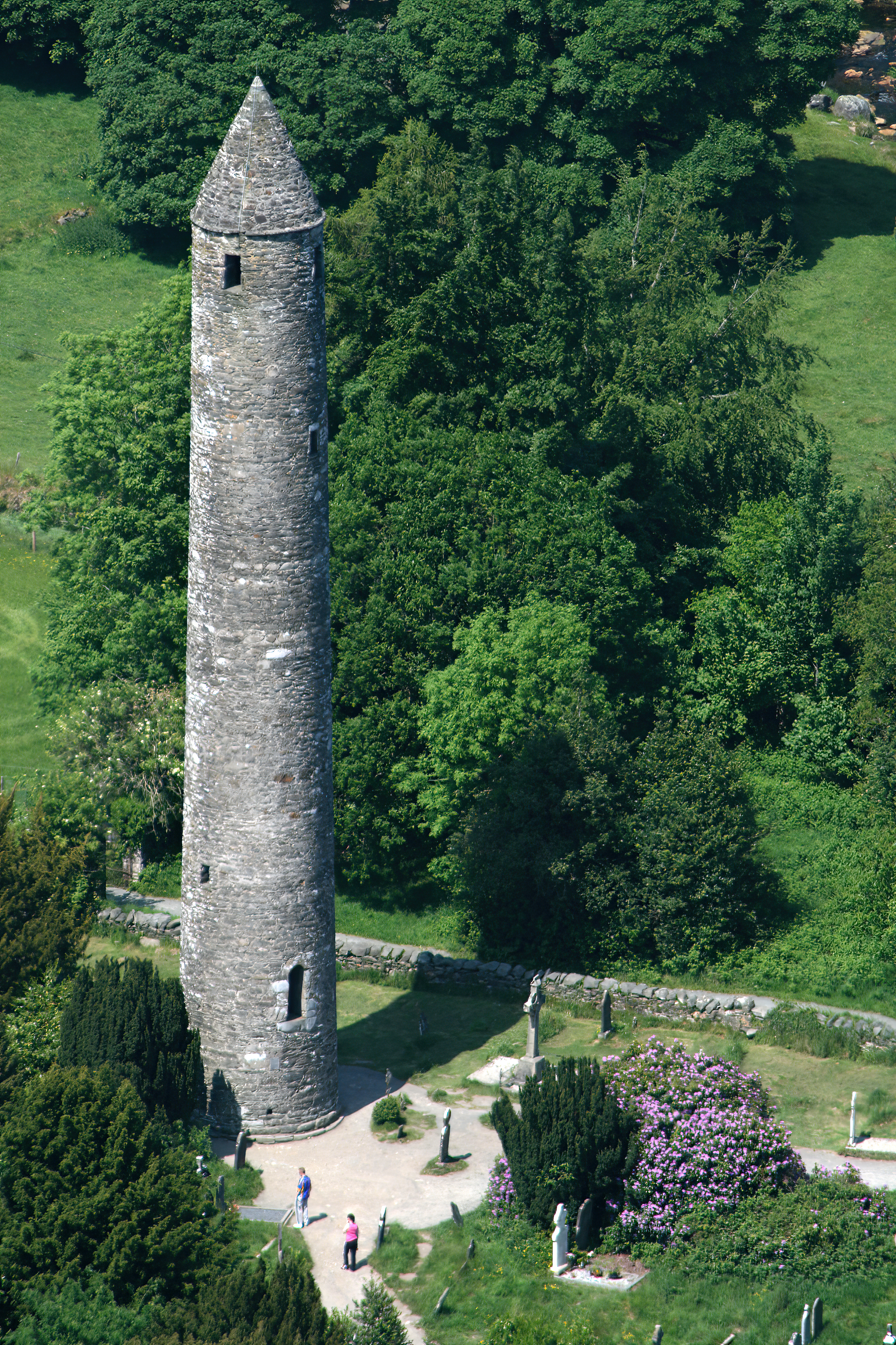
Glendalough Round Tower
Glendalough represents iconic Irish countryside.  Nestled in a glaciated valley in the heart of County Wicklow, this serene valley boasts two lakes, monastic remains with a superb round tower, stone churches, and decorated crosses in an historical graveyard. Literally the name, Gleann Dá Loch, means “Valley of the Two Lakes.”

History
The early Christian ecclesiastical settlement was founded in the 6th century by St. Kevin, a hermit monk who died about 618 A.D.  A descendant of one of the ruling families of Leinster, he came to live at Glendalough (pronounced ‘glenda-lock’) as a young man.  According to legend, he lived a life of sleeping on stones, wearing animal skins, barely eating, and making friends with birds and animals.

By the 9th century, Glendalough rivaled only Clonmacnoise as one of the leading monastic cities in Ireland.  In its heyday, the settlement not only featured a monastery and monk cells, but also an infirmary, workshops, areas for manuscript writing and copying, guesthouses, farm buildings and houses.  Most of what survives today is from the 10th-12th centuries.

In 1214, the dioceses of Glendalough and Dublin were combined and the settlement fell into ruin destroyed by English forces in 1398.  The Feast of St. Kevin is celebrated on June 3.

Glendalough is currently a titular see in the Catholic Church.  It is used for bishops who hold no ordinary power of their own and thus are titular bishops.

Visiting Glendalough
Upper Lake at Glendalough
The two lakes at Glendalough are known as Upper Lake and Lower Lake, where the main entrance from the parking area, a visitor centre, the main monastic dwellings, and a hotel are located.  Walking trails connect the two lakes and other monastic sites.

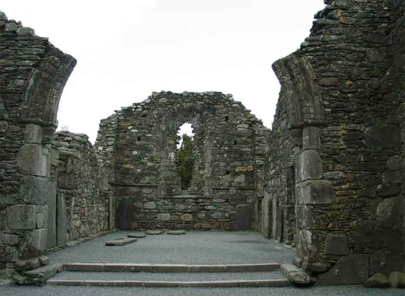
Visible at Lower Lake are the double-arched medieval gateway; the Cathedral, the largest building; St. Kevin’s Cross with an unpierced ring; the reconstructed priests’ house; St. Kevin’s Church (or Kitchen) with its distinctive round belfry; foundations of St. Kieran’s Church; and the iconic round tower.

The round tower possibly served as a belltower, a place of refuge when under attack, and/or a storage facility.  It originally had six timber-floored stories with the doorway to the tower 3-1/2 meters above ground to protect those inside from intruders.

Small windows at the top face the four points of the compass, and stories were accessed by internal wooden ladders.  The conical roof was replaced in 1876 from original stones.

Additional monastic structures – St. Mary’s Church, the CaherReefert Church, and St. Savior’s Church – can be visited on the hike to Upper Lake. Temple-na-Skellig and St. Kevin’s Bed, a cave, are only accessible via boat.

Crosses of Glendalough
There are nine marked walkingtrails in Wicklow Mountains National Park ranging from a short half hour walk to a four-hour hillwalk.  The park is host to a wide diversity of wildlife including red deer, sika deer, fallow deer, feral goat, red fox, mink, and over 100 species of birds.  The common lizard is the only reptile in the park, as there are no snakes in Ireland.

The visitor center located nearby hosts an interesting exhibit and a 17-minute film entitled “Ireland of the Monasteries.”


Join Rick Steves in this video: “Glendalough, Ireland: Exploring the Wicklow Mountains.”  (Watch only the first 1:55 minutes.)
For a unique birds eye view, enjoy this video: “Glendalough.” (3:40)


Wednesday, February 20, 2013

Slovakia and the Tatra Mountains

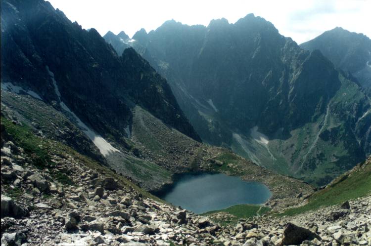
Tatra Mountains

Although our tour is billed as a four-country tour with stays in Germany, Czech Republic, Poland and Hungary, there is actually a fifth country included – Slovakia.

On day 8, on the drive between Krakow, Poland and Budapest, Hungary, we are treated with a drive through the beautiful Tatra Mountains situated in the northern part of Slovakia, one of the smallest mountain ranges in the world.

In 1993, the Tatras were declared by UNESCO to be the “Biospheric Reservation of the Tatras.”  There are 25 peaks surpassing 2500 meters above sea level.  The highest peak in the range is Gerlachovsky peak (2655 m.) making the Tatras a great winter sport area.

There are 85 mountain lakes on the Slovak side of the Tatras nestled in the valleys.  At the end of the valleys are beautiful waterfalls that make the Tatras even more breathtaking. These 360-degree images give a sweeping view of the mountain lakes.

The Tatras also play host to a wide variety of flora and fauna from the lovely blue willow gentian to the cedar pines that grow on the steepest back of the hillsides.  The Tatra chamois, wolves, and brown bears find homes in the deep forests.

Although this day may appear to be a long bus ride to our final destination, it is definitely not a day for napping on the bus.  In this case, the phrase “you snooze, you lose” is really quite appropriate!