Friday, January 9, 2015

Ancient Church Ruins of St. Cuthbert, Northern Ireland

About a half mile from Dunluce Castle, on Ballytober Road, are the ancient church ruins of St. Cuthbert’s, named for the Northumbrian monk.  Built on the site of a much older medieval church, it was completed in the late 1630s. 

Lady Katherine Manners, wife of the first Earl of Antrim Randall McDonnell and widow of the late Marquess of Buckingham, is credited with building, or at least completely renovating, the church.  Although both the Earl and Countess were Catholic, they provided a place of worship for the Protestant settlers in the area—a rarity for church tolerance in the region.

The church was originally thatched and the white ceiling, according to memoirs of the time, was painted with signs of the zodiac.  It served the Parish of Dunluce from 1622-1821 when the new Church of St. John the Baptist was built in BushmillsSt. Cuthbert’s was then unroofed, as was the custom, and the contents sold at auction. 

The first known vicar of St. Cuthbert’s was a William Wallace from 1622-35, who served Dunluce, Portcaman, Ardclinis, and Derrykeighan, where he resided.  In 1634, it was recorded that he was contemplating moving to New England.

Using the headstones in the graveyard at St. Cuthbert’s, historians have pieced together some of the backgrounds of the inhabitants of the merchant village of Dunluce located near the castle, as well as the surrounding parish. 

The oldest readable stone is from 1630 and marks the burial site of two of the children of Walter Kidd, a merchant of Dunluce and Burgess of Irvine.  To read inscriptions on all the headstones, go here. (Scroll down to ‘Kid’ and read the actual inscription.)

It seems the Kidd family has kept records of their Irish ancestor and for a fascinating read on Walter and his family and profession, go to this genealogical document and scroll down to page 17.

The Ireland Genealogy Project Archives also has photos and texts of many of the stones in the cemetery.

La Girona banknote
Local folklore tells of sailors and noblemen buried in the open part of this cemetery to the south of the church in 1588.  They died when their ill-fated Spanish Armada Girona floundered off the coast near Dunluce at Port na Spaniagh (or the Bay of the Spanish).  Indeed, Earl Randall McDonnell mounted cannons taken from the wreckage on the Dunluce Castle parapets as well as possessed other artifacts from the ship.

Interestingly, the wreck of the Girona was simply a local tale told for 400 years until 1967 when Belgian diver and treasure hunter Robert Stenuit discovered the sunken warship off Lacada Point.

Another artifact at St. Cuthbert’s said to have come from the shipwreck was a muniment chest used for manuscripts and religious purposes, although it is not extant.

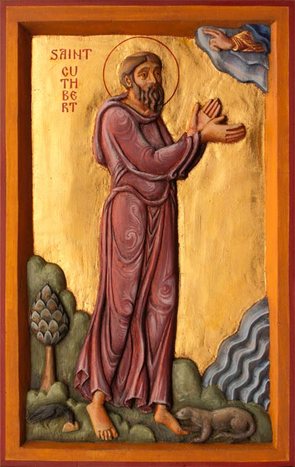
Note: The relics of the Northumberland monk St. Cuthbert (635-687 AD) now lie in Durham Cathedral where they were brought after the Viking raid in 793 on the monastery on Lindisfarne, or Holy Island, off the northern coast of England.

St. Cuthbert's Church near Dunluce Castle

Tuesday, January 6, 2015

2015 -- 15 Tips for International Travelers


Travel Guru Rick Steves recently posted an article on his web site about 15 Travel Skills for 2015.  Those of you who have travelled with me before will recognize a few of them, but it is in everyone's best interest to have "the best perspective-broadening experiences and life-long memories," Steves says.  And to do that, he recommends strongly that we "travel smart."

Be sure to go to Rick Steves' link above and review his top 15 practical trips for travel.  Feel free to comment below if you want to add to any his tips.

Saturday, December 27, 2014

Dunluce Castle, Northern Ireland

Aerial view of Dunluce Castle
Thought by many to be the most romantic and picturesque of Irish castles, the ruins of medieval Dunluce Castle sit atop a rocky outcrop overlooking the Irish Sea on the Antrim coast of Northern Ireland.  It is joined to the mainland by an arched walkway, or bridge, over a 20-foot chasm.

The 17th century mainland courtyard, containing domestic buildings, leads downhill to a narrow crossing to the rock, formerly protected by a drawbridge to the gatehouse. The buildings on the rock are from the16th and 17th century.

The earliest mention of Dunluce Castle is in the fourteenth century, and it is believed to have been built by Richard de Burgh on the site of an old fortress.  It was later occupied by the McQuillans around 1513.

Dunluce Castle
Forty years later, Sorley Boy McDonnell, a Scottish chieftain who controlled the northeastern coast of Ireland, claimed the castle for the McDonnell clan.  But in 1584 Queen Elizabeth I ordered Sir John Perrott to take the castle for England.  Sorley Boy fled but was able to retake the castle with help from inside. 

It is he who mounted the four cannons on the gatehouses obtained from the Spanish galleass Girona which foundered on Lacada Point near the Giant’s Causeway in 1588.  Funds obtained from selling the recovered cargo from the ship was used by Sorley Boy’s son to modernize the castle.

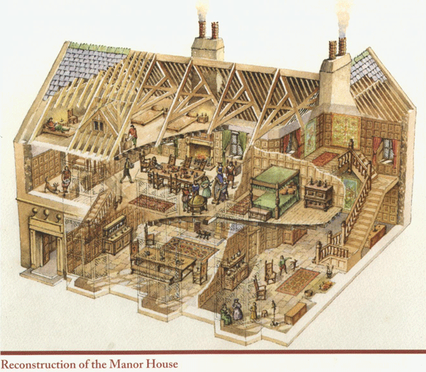
McDonnell’s son, Randal, is credited with restoring the castle and building a lavish manor inside the castle walls.  Randal married the widow Lady Katherine Manners and the Earl and Countess of Antrim set about appointing the castle with the finest of decorations.  An inventory of the period shows fine tapestries and curtains, including one set that had belonged to Cardinal Wolsey of Hampton Court.

The inventory lists over sixty elaborately upholstered chairs, a library of books, saddles worked with gold and silver, fine cabinets, and priests’ vestments.  The Countess is also credited with establishing St. Cuthbert’s Church near the castle.
Dunluce Castle 

The village which grew up around the castle around 1608 was a thriving merchant town as evidenced by the headstones in St. Cuthbert’s graveyard.  Currently there is an archaeological project being conducted to unearth the village ruins destroyed in the 1641 rebellion when it was besieged by the Irish army. 

Most of the Scottish residents escaped to Scotland before the village was burned to the ground.  The village was revolutionary for its age as it boasted indoor toilets and cobblestone streets laid out in a grid. These 21 videos, Discovery of a Lost Town: Dunluce, (1 hour, 8 minutes total) chronicle that dig.

During the 1641 rebellion, the Earl was captured by Scottish General Robert Monro. After his release he lived in Dunluce Castle until his death in 1683.  After the Battle of the Boyne in 1690, Dunluce was abandoned and Ballymagarry became the principal residence of the McDonnell clan until 1745.

Diagram of Dunluce at its peak
The castle was given to the Northern Ireland government in 1928 to be preserved as a National Monument.

Many legends surround Dunluce Castle…some true, some just myth.  Below the castle is Mermaid’s Cave where legend says a lost soldier was dragged to the depths by a beautiful mermaid.  Other stories tell of smugglers and Spanish treasure hidden in the depths of the cave.

One of the most famous stories is purported to have occurred during a storm in 1639 when the kitchen, along with seven servants, fell into the sea. 

And just for fun…here are 50 things you probably never knew about Dunluce Castle. (Note: I guess #1 is still up for debate!)

The Castle in Popular Culture

The castle is thought to be the inspiration for Cair Paravel in C.S. Lewis’ Chronicles of Narnia.  In 1973 the castle appeared on the inner gatefold of the multi-million selling Led Zeppelin album Houses of the Holy.  The castle appeared as Snakehead’s hideout, called Ravens Keep, in the 2003 Jackie Chan movie The Medallion.  Dunluce Castle also represents the House of Greyjoy, ruler of the Iron Islands, in the TV series Game of Thrones.

Visiting Dunluce Castle

Audio/visual guides are available on site that allow visitors to view animations of the castle’s structures rebuilt before their eyes to create an engaging and immersive visitor experience.   However there are lots of information boards throughout the ruins to keep visitors informed. A video is also available in the discovery room. 

An app for iphone and android devices has been developed for Dunluce Castle. This is now available, free of charge, from the App Store and Google Play.

To reach the castle, there is a short, casual walk from the carpark across a wooden bridge to the castle.  The bridge spans the chasm which separates the castle from the mainland.  There is also a walk down steps to the cave underneath the castle.

For some beautiful scenery, try this 360 tour from the bridge to the castle.

These videos provide a good background for visiting Dunluce Castle:
Dunluce Castle, County Antrim, Northern Ireland (1:05) shows the stairs to the cave.

Here you can print off your own Guide Card to Dunluce Castle for the most complete information on the ruins.


Friday, November 21, 2014

Giant's Causeway, Northern Ireland

Anything with a name like the Giant’s Causeway is bound to have a legend attached that explains the origins of this unique geological formation found on the northern Antrim Coast of Northern Ireland where the Atlantic Ocean meets the Irish Sea.  And it goes something like this…

The Legend of Finn McCool
The Irish giant Finn McCool builds a giant raised road, or causeway, across the sea to the coast of Scotland to meet the Scottish giant Benandonner in battle.  Once he arrives in Scotland, he quickly discovers that Benandonner is a much bigger giant than himself, and Finn runs back across the causeway to home.

Finn’s wife disguises him as a “baby” by putting him in a bathtub-turned-cradle, and when Benandonner sees Finn as a giant “baby,” he quickly decides that if the “baby” is this big, then his father must really be huge.  In fear, Benandonner runs back to Scotland, tearing up the causeway along the way…hence it is called – the Giant’s Causeway.

Listen to the story (read with an Irish accent!) with illustrations here to get a more complete and entertaining telling of the legend. Make sure the sound and auto are turned on (and it worked better in Google Chrome, than Internet Explorer).

Now watch the short 2.5-minute animated version The Myth of Finn McCool that plays in the Giant’s Causeway Visitor Center.

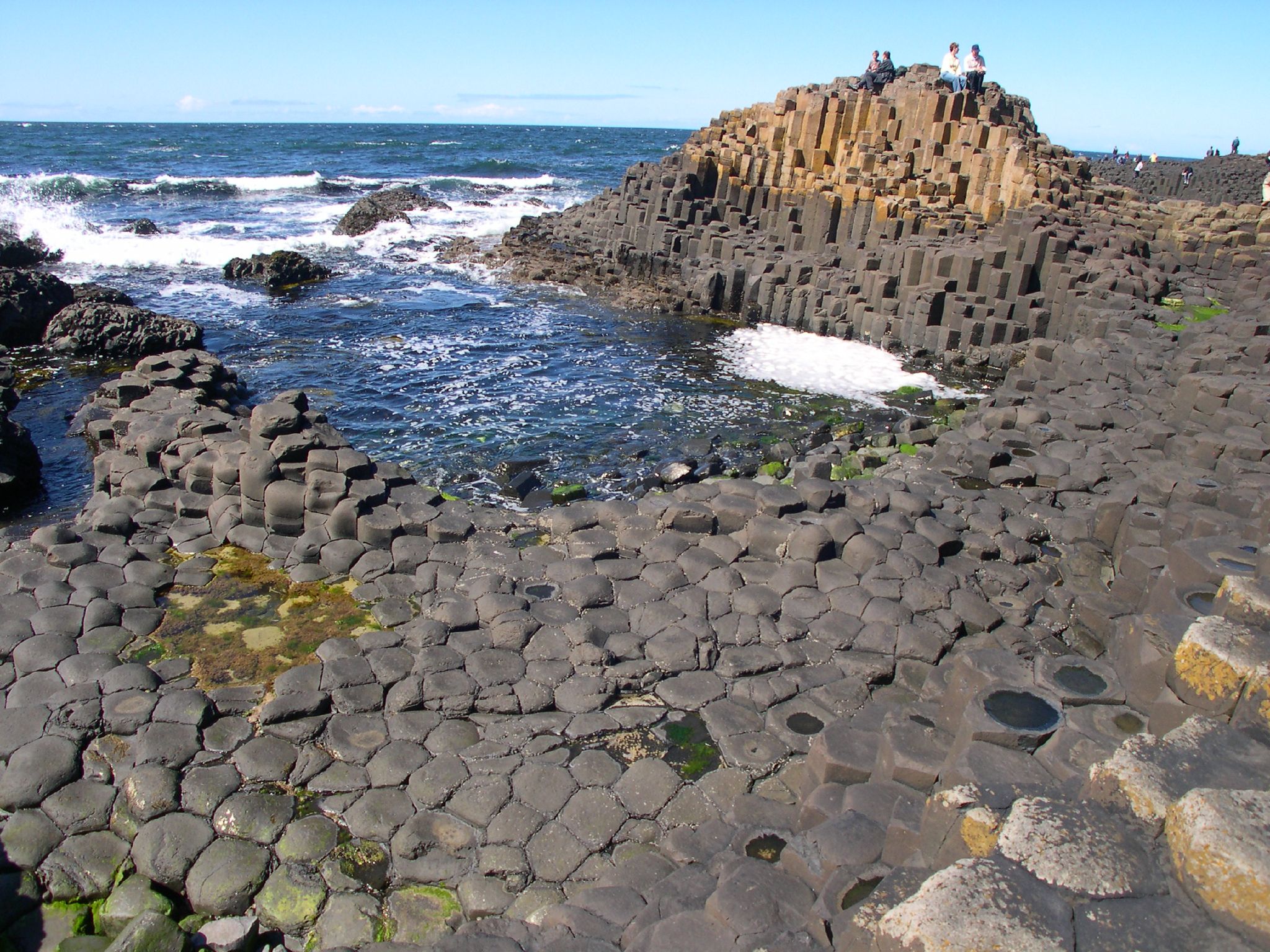
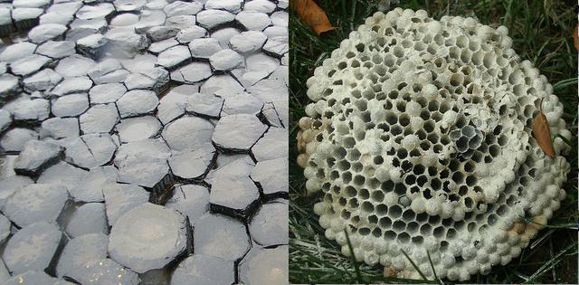
But was it really giants that created this geometric wonder that has been named a UNESCO World Heritage Site?  Even though there is more to the Finn McCool story, scientists say that the mostly hexagonal shaped columns are the result of volcanic activity over 60 million years ago.
Giant's Causeway basalt columns 

Basically, fluid basalt flowed up through chalk beds to form a lava plateau.  And much the same way as mud dries leaving cracks, so did the basalt creating nearly 40,000 columns.  Years of weathering created many of the mythical sites along the coast.

Some of these must see sites include: the Grand Causeway, the largest of three rock outcrops; the Giant’s Boot, a large formation resembling Finn’s boot lost in his flight…a size 93.5 by scale; the Camel’s Hump, known as Finn’s camel turned to stone it is a basaltic dyke of cooled lava; the Wishing Chair, a natural formation worn smooth over time and once reserved only for ladies; and the Shepherd’s Steps on the far end of the coastline walk, 167 very steep steps connecting the coast trail and the cliff trail and best experienced going down!

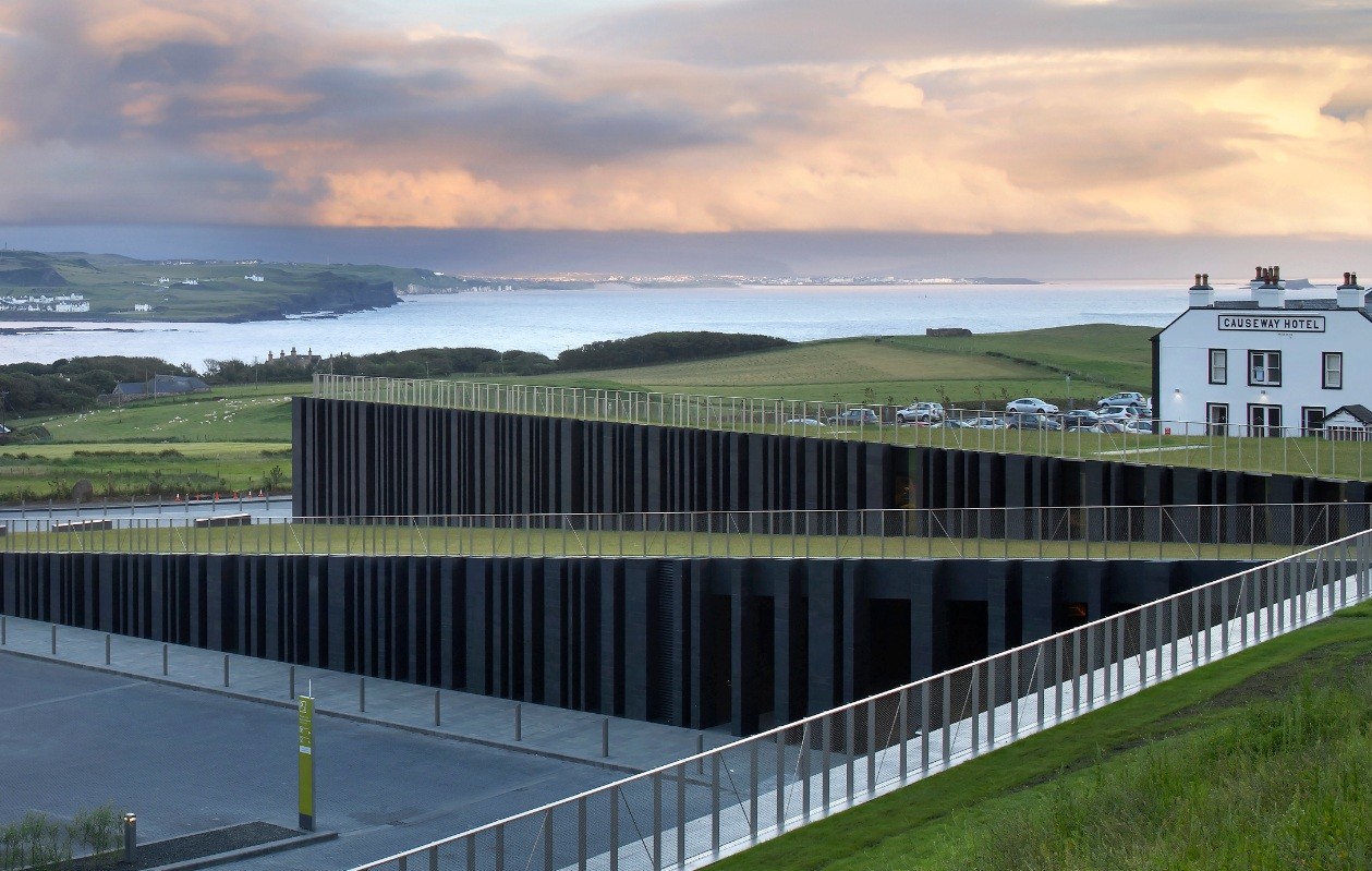
Other notable sites along the coastline trail include the Organ, the Chimney Stacks, Giant’s Eyes, the Honeycomb, the Giant’s Harp, and the Giant’s Gate.  The modern visitor center opened in 2012 and operated by the National Trust offers interactive exhibits, a restaurant, and a gift shop. Audio guides are also available through the center.

For a complete map of all paths and sites to see, go here.  For individual trail maps for coastline and cliff top walks to download, go here.  And to enjoy 360-degree virtual online tours, go here.

Giant's Causeway hexagonal columns
From the parking lot and visitor center, there is a half-mile downhill walk to the coastline trail along the causeway columns.  Fortunately, there is also a shuttle bus that runs to and from the coastline trail and it shares the same route as the walking path. Walking down would be fine for most but walking back to the main building could be tough.

Appropriate dress also enhances a visit to the Giant’s Causeway.  It can windy and cool and/or rainy, so dress appropriately for coastal winds which make the area cool regardless of the season.  Good walking shoes are necessary as the basalt columns can be wet either from rain or splashing waves. 

Giant’s Causeway, N. Ireland (5:36) is a good narrated video to see the site and understand the basis of the legend of Finn McCool.

Although this video Giant’s Causeway (11:25) is a bit long, it gives you a complete picture of visiting the site as a tourist.  At the beginning notice the shuttle bus on the road down to the coast and the tourists walking down.  At the end, this tourist walks up the Shepherd’s Steps and you can hear him huffing and puffing in the background!  (Just a little video to see the importance of the shuttle bus at the Giant’s Causeway!)

From an historical perspective, the Spanish Armada’s flagship Girona sank near the Giant’s Causeway in 1588…a secret that only locals knew about for over 400 years.  It was 1967 before the wreck and its many treasures were discovered off the Antrim Coast.


Wednesday, October 29, 2014

Carrick-a-Rede Rope Bridge, Northern Ireland

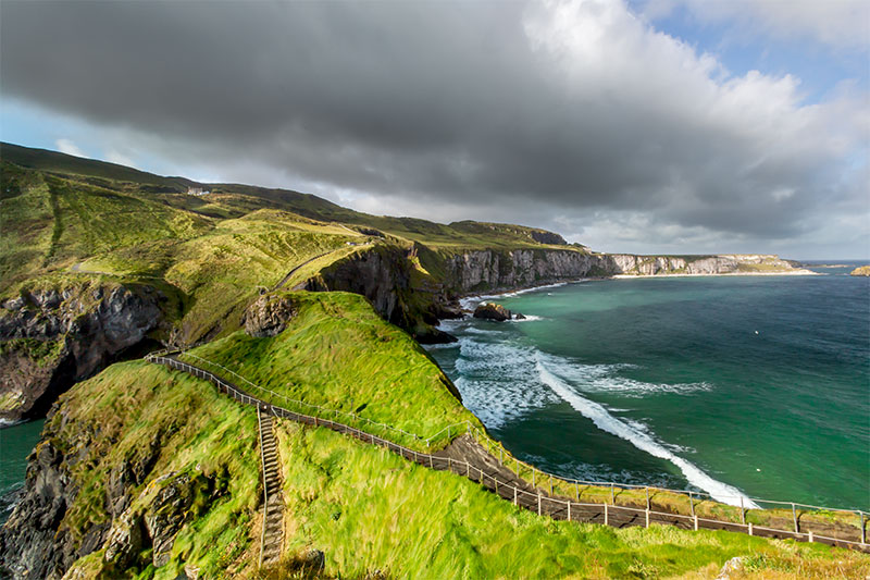
Located in the northernmost corner of Northern Ireland near Ballintoy in County Antrim is the unique Carrick-a-Rede Rope Bridge that spans a narrow 98-foot deep chasm allowing access to a beautiful island. The 65-foot long bridge connects the mainland to tiny Carrick-a-Rede Island and, although it has been rebuilt several times over the years, a bridge has spanned this rocky area for almost four centuries.

Carrick-a-Rede Rope Bridge
From here you can actually see Rathlin Island and the Scottish isles!  The Mull of Kintyre is the most visible part of Scotland just beyond Rathlin.

An earlier bridge was just a single rope handrail and widely spaced slats used by fishermen to check their nets on the island, which provided great salmon fishing grounds until 2002.  In fact, the name is Irish for “rock of the casting.” The current two-handrailed bridge was erected in 2008 by the National Trust for an easier and safer crossing.

The views from the bridge and the island are spectacular, but warning signs also urge visitors to be careful.  There are few guards and railings on the island cliffs, so be sure to watch your step while exploring on marked paths.  Click here for a 360-degree view of the area.

There’s a 30- to 45-minute coastal walk up to Carrick-a-Rede, and there are some steep steps and stairs.  No one has been injured falling from the bridge, but some have feared the crossing back to the mainland.  What happens to them?  Click here to find out.

Afraid of heights? Not to worry.  The views from the mainland are just as beautiful as from the island.  Taking the rope bridge challenge just provides an adrenaline rush and another notch on your “I did it” belt!

As a reward for crossing the bridge, enjoy tea and cake and the lovely view at the WeighbridgeTearoom located on Carrick-a-Rede Island.

Rope Bridge to Carrick-a-Rede Island
The area around the bridge is also rich in geology, flora, and fauna diversity and is designated an Area of Specific Scientific Interest.  The island is one of the best examples of a volcanic plug in Northern Ireland.  Marine erosion has exposed an area of this geological wonder.

Noisy seabird colonies of fulmars, kittywakes, guillemots, and razorbills breed on the islands close to the rope bridge.  Sheep and cattle also graze in nearby meadows. Porpoises, dolphins, and sea lions have been spotted in the waters below, as well as a basking shark! 

Wild thyme can carpet the area in pink and at least three different types of orchids can be found around the sites as well as other wildflowers.  Even the Facebook page of the National Trust shows that the Northern Lights were visible from the nearby town of Ballintoy!

Other sites in the area include Larry Bane,once a chalk quarry in the mid-1970’s, but now an access point for a walk to the rope bridge and a 400-year-old restored fisherman’s cottage to show the connection between the bridge and a once thriving industry.

Locations around Larry Bane and Ballintoy have been used as sets for episodes of the highly popular HBO series Game ofThrones, such as Renly’s Warcamp.

Click here for a handy pdf map of the Carrick-a-Rede walking trail and bridge.  You’ll see that the walking path to the bridge is much longer than the walk over the bridge.

Join this visitor in his walk across Carrick-a-Rede Rope Bridge video to get a feel for life on the edge!

Wednesday, October 15, 2014

Ireland vs. Northern Ireland...What's the Difference?

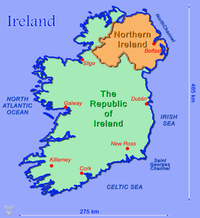
Technically speaking, Ireland is the island.  But on this island are two separate political countries…the Republic of Ireland and Northern Ireland.  The Republic of Ireland is an independent sovereign nation.  Northern Ireland is part of the United Kingdom of Great Britain, which also includes Scotland, Wales, and England.

Until 1921, Ireland was one undivided country under British rule.  So why are they split? What started as a religious issue between the Protestants and the Catholics, has now become a social and cultural conflict.

Traditionally, Ireland is a Catholic country.  There are still Catholics in Northern Ireland, but when citizens of England and Scotland started emigrating to the northern part of Ireland 500 years ago, they brought their Protestant religion with them, so they feel more culturally linked to Great Britain through their Protestant ancestors.

(Remember England was also Catholic until King Henry VIII got mad at the pope in the 16th century for not recognizing his marriage annulment from Queen Catherine so he could marry Anne Boleyn.  In defiance he “protested” and started the Church of England.)

Under pressure from the mostly Protestant population in the North to remain with the Protestant United Kingdom, the British and Irish governments forced the division of the island into the north and the south.

The IRA (Irish Republican Army) is a Catholic paramilitary organization whose goal is to force the British out of Northern Ireland.  This terrorist group organized in 1919 and is believed responsible for hundreds of deaths in the late 20th century.

The period after 1968 is referred to as “The Troubles.”  British soldiers came in 1969 to restore order but unfortunately took sides and discrimination of Catholics continued.  Extremists from both sides took the law into their own hands resulting in thousands either killed or imprisoned.

Ireland governs itself, and so did Northern Ireland until the 1960s when the civil unrest forced Great Britain to impose Home Rule.  In the early 21st century, Northern Ireland regained some of its independent government, but it continues to remain under British Sovereign law. 

There are also a few other differences.  For example, the Republic of Ireland uses the euro for its currency, while Northern Ireland uses the pound sterling as part of the United Kingdom.  In addition, speed limits in Northern Ireland are shown on signs as miles per hour, while Ireland uses kilometers.  And look at the mailboxes: Northern Ireland mailboxes are red, while those in the Republic of Ireland are green.  That helps you tell when you’ve crossed the border.

Regardless of their differences, the two countries both approved the Belfast Agreement, also known as the Good Friday Agreement, in 1998 which stated that the majority of the people of Northern Ireland want to remain a part of the United Kingdom and that a substantial number of people in Northern Ireland and most of the people of the island of Ireland want a united Ireland.

The agreement basically says that both viewpoints are equally legitimate and that the two countries will remain as they are until the majority of both Northern Ireland and the Republic of Ireland want the two united.  The political leaders Catholic John Hume and Protestant David Trimble later received the Nobel Peace Prize for their contributions.

However, in many places in Belfast, the lines are still drawn.  “Peace Lines” (walls topped by barbed wire) can still be seen segregating factions of Catholic supporters and Protestant supporters. 

Northern Ireland mural 
Although Northern Ireland is a more peaceful place, one can still see, especially in Belfast, territorial flags, murals, or curbstones painted red, white, and blue for Protestant Loyalists or orange, green, and white for Catholic Republicans.

Tourists are encouraged not to show any support to either faction while traveling through these areas by wearing group colors or waving union flags.  Just to be safe, avoid initiating conversation with locals on politics or religion, and shy away from political demonstrations or controversial parades.  It is best to err on the side of caution.

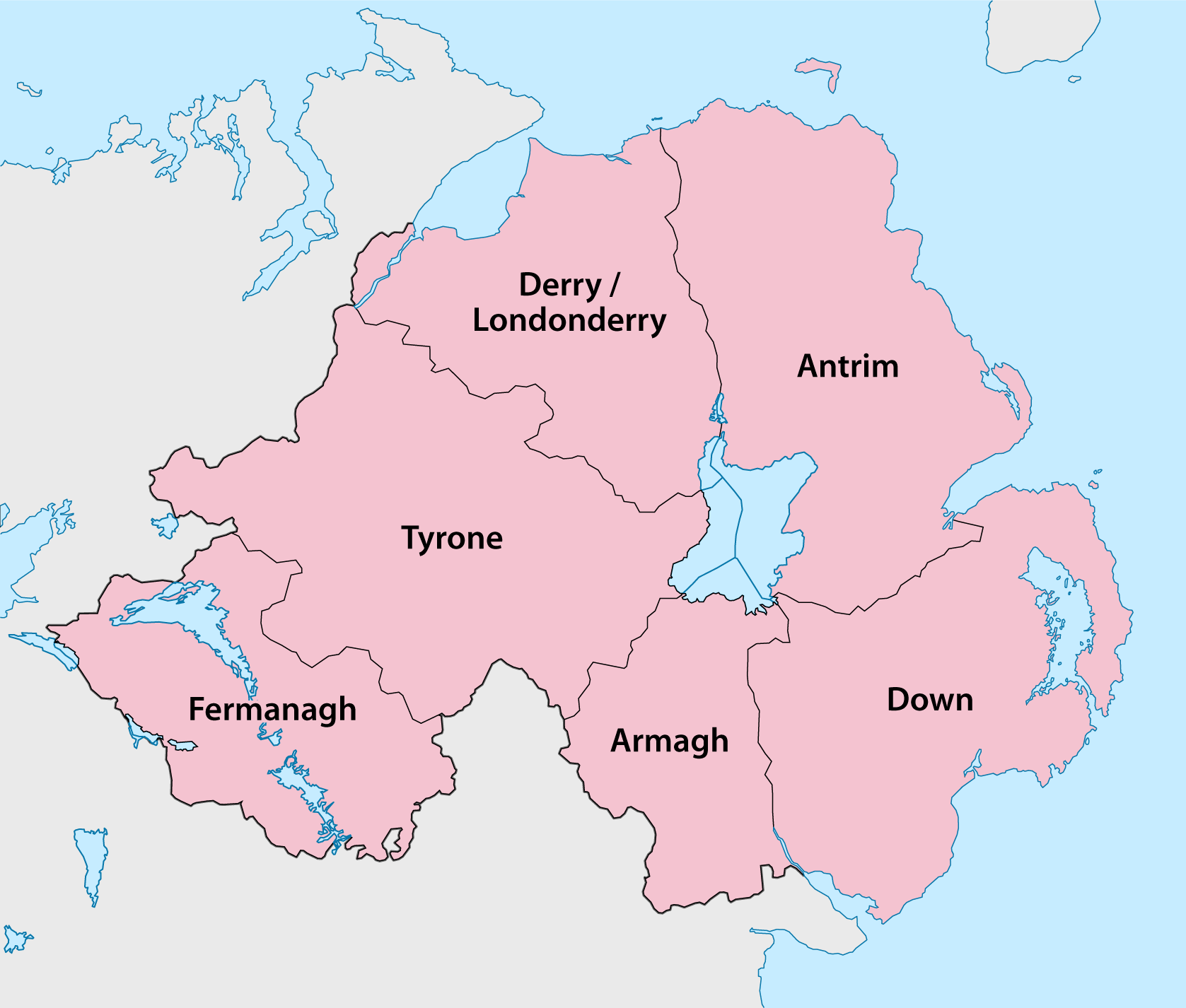
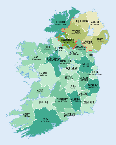
Today Northern Ireland is composed of six counties, while Ireland has 26 counties.  Confusingly, Northern Ireland is also a part of the province of Ulster (one of four ancient Irish provinces), which also includes three counties from the Republic of Ireland.

Still confused?  Watch this video “Get It Right” (1:16) and see just how “simple” it is!

The first half of this video from Rick Steves “Belfast and the Best of Northern Ireland” (26:08) explains a little more about Belfast and the Troubles. 

And if you are a history buff, you might like this entertaining video “A Brief History of the Conflicts in the North (of Ireland) (10:24).” It begins at THE beginning and carries you through to current times.  (Note: Remember to breathe somewhere in the middle of it.  It carries you pretty fast!)

Monday, October 6, 2014

Experience the Titanic’s Journey through Primary Resources

Worldwide newspaper coverage of the tragic event
Original ticket issued to Mr. David Moneypenny, a Harland & Wolff painter who worked on Titanic’s first-class accommodations.

Even though this is designed as a classroom resource, the original documents (enlarge to view) and the accompanying questions verify the various types of passengers who sailed on the Titanic

Eva Hart was 7 years old when she boarded the Titanic.  She survived with her mother, but her father was lost.  In this interview, Eva shares some of her memories.  She died at age 91 in 1996.

Her published written account.  Check your library.

A Titanic Survivor – video (4:00)
Millvena Dean was only 9 weeks old when she boarded the fateful ship; she was the youngest survivor…and the last survivor to die.  She died at age 97 in 2009.
Titanic survivors aboard the Carpathia

Interviews recorded in the 1970's and 1980's with survivors Frank Prentice (a crew member who jumped into the icy waters), Eva Hart, Edith Brown, Ruth Becker, and Edith Rosenbaum (an American returning home).

Titanic survivor and first-class passenger Dr. Washington Dodge provided a written statement about the Titanic tragedy aboard the Carpathia, the ship that rescued him and his family.  It was written shortly after his rescue on Carpathia stationery.  (Scroll down a bit and click on full transcript just above ‘Excerpt’ to read his entire account.)

Listen to recordings and read written accounts from passengers and stewards who survived the tragic sinking.

A list of links to photographs, newspaper clippings, and handwritten accounts.  Scroll below the complete list for enlargements of each or click on the links to go to the original web sites.  Pop Quiz:  Can anyone identify the photo of the first lady on the list—Mrs. J.J. Brown?  What became her nickname after the sinking of the Titanic? Here is a transcript of her obituary from the New York Times in 1932.

Front page coverage of the historic tragedy.  You can click above the page to convert to text or pdf for easier reading.  This is only one newspaper’s account.  The event received worldwide coverage.  Search for other newspaper’s accounts and see how they compare.

See the underwater remains of the ship sprawled across a thousand acres of the ocean floor through sonar imaging.  It shows that the ship broke in half before resting on the bottom of the Atlantic.  Click on the numbers to explore the debris field.

National Geographic photos show the remains of the historic ship as it rests at the bottom of the sea as well as some of the recovered artifacts.

First-class passenger ticket on the Titanic
Within this article are several primary source documents to enlarge and read.

Read some of the claims filed against the owners of the Titanic

Search the actual document listing passengers rescued by the Carpathia from the Titanic

The Smithsonian’s National Museum of American History has several artifacts related to the sinking of the Titanic.  This article only provides a list of items and information about them.  However, if you conduct an image search for an article by name, you might just see what it looks like.  One of the fascinating items and its story is the Bernice Palmer Ellis’ Kodak Brownie camera.