Occasionally I am going to post assorted quick tips for travelers. There will be no particular theme…just random things I’ve heard that work or great ideas I see in magazines or on TV. If you have an idea that you’d like to share with the rest of the group, just send it via email and I’ll include it in the next Quick Tips posting.
--Sometimes a cramped cruise ship bathroom doesn’t offer a lot of space for towels or other toiletries. Try packing a quick-release suction cup with a hook to hang your toiletry bag from.
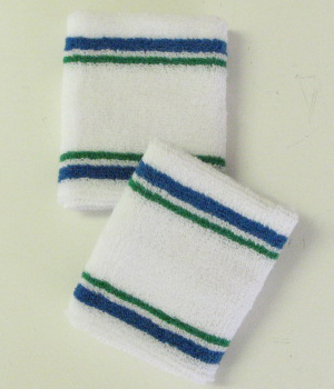
--To protect the lens of a bulky camera without keeping it in a case, try slipping an extra-wide tennis wristband over the camera lens and viewing screen. That way you can avoid scratches while putting your camera in a purse or backpack.
--Flat irons aren’t just for hair. Put it on a low setting and touch up the seams of shirt sleeves or cuffs of shorts or pants. And try using your blow dryer to take the wrinkles out of clothes. Hold it a few inches from the garment and move slightly back and forth.
--Want to know what it’s really like where we are going? Then check youtube.com. Lots of people post their vacation videos online. You’ll get a feel of what it will be like from a real person’s point of view rather than just a guidebook description. Here is an example of the Greek island of Rhodes.
--Bumpy airplane rides? I hope not, but try strong peppermints. Peppermint oil found in strong mints like Altoids is one antidote for an upset stomach.
--Another way to look at our trip. Download Google Earth, a free app for your PC or iPhone. Search for any of our destinations and get a satellite view that you can zoom in to. Some places show up fairly clear in this aerial view. Here is another example of Rhodes. Warning: Playing with Google Earth is addictive!!
--And I know this one is going to sound outrageous and I don’t know that I would do it because I would feel so conspicuous on the plane, but after spending 12 hours on the flight to and from China I know it would have worked. I read where someone took an inflatable beach ball on flight. After blowing it up, they used it to lean over and sleep on! All I could think of on that long flight was how much my back would appreciate that beach ball! There's also an inflatable neck pillow that takes up little space in baggage. I like the cushioned neck pillow. Even though it is bulkier, it is more comfortable for me. I don't pack it...I just slip it through the handles of my carryon bag.
Send me your tips!